Explore
Featured
Recent
Articles
Topics
Login
Upload
Featured
Recent
Articles
Topics
Login
Upload
Search Results for 'data modis'
data modis published presentations and documents on DocSlides.
Use of MODIS data to assess global Landsat surface reflectance products
by aaron
Chengquan. Huang. 1,2. . Min Feng. 1,2. , . Jos...
MODIS downward shortwave radiation (DSR) and photosynthetically active radiation (PAR) products (MC
by eve
Dongdong Wang, . Shunlin. Liang. Xueyuan. Gao, M...
Creating a global aerosol data time series from MODIS, VIIRS and beyond
by eatsyouc
Robert C. Levy (NASA-GSFC). robert.c.levy@nasa.gov...
Characterization of Aerosol Data Quality from MODIS for Coa
by pasty-toler
Jacob Anderson. Mentor: Gregory . Leptoukh. Resea...
Transition from MODIS AOD
by ellena-manuel
VIIRS AOD. Robert Levy. . (NASA-GSFC). Shana...
Remote Sensing of Ecosystem Productivity Using MODIS
by alexa-scheidler
. F. red Huemmrich, UMBC/GSFC . John Gamon, Univ...
Collection 6 update: MODIS ‘Deep Blue’ aerosol
by briana-ranney
Andrew M. Sayer, N. Christina Hsu, Corey Bettenha...
MODIS/VIIRS Surface Reflectance
by eddey
Eric Vermote. NASA GSFC Code 619. eric.f.vermote@n...
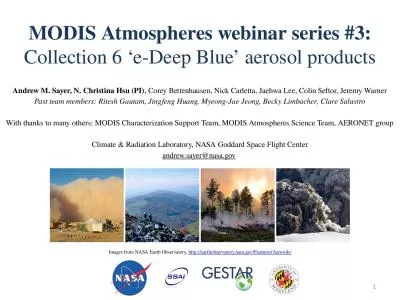
MODIS Atmospheres webinar series #3:
by ashley
Collection 6 ‘e-Deep Blue’ aerosol products. A...
Volcano monitoring using MODIS
by sophie
. Robert . Wright. Hawaiʻi. Institute of Geoph...
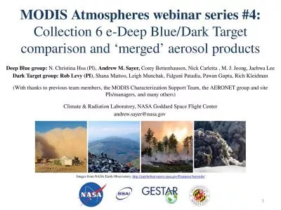
MODIS Atmospheres webinar series #4:
by thomas
Collection 6 e-Deep Blue/Dark Target comparison an...
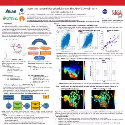
Data Used: Assessing terrestrial productivity over the
by jones
ABoVE. Domain with MODIS Collection 6. This mater...
Combining Data Assimilation with an Algorithm to Improve th
by briana-ranney
Toward a Multidecadal, Multisensor Global Record....
EVALUATION OF SMAP LEVEL 2 SOIL MOISTURE ALGORITHMS USING SMOS DATA
by mitsue-stanley
Rajat Bindlish. 1. , Thomas Jackson. 1. , Tianjie...
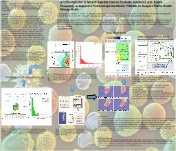
GC21B-0953 Use of MODIS Satellite Data
by giovanna-bartolotta
to Evaluate . Juniperus . spp. .. Pollen Phenolo...
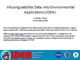
Infusing satellite Data into Environmental Applications (
by natalia-silvester
IDEA):. R. Bradley Pierce. NOAA/NESDIS/STAR. PM2....
Achieving Consistency in the Multi-Mission Ocean Color Data
by alexa-scheidler
MODIS Science Team Meeting. 19 May 2011 – Colle...
VALIDATION OF THE NPP VIIRS ACTIVE FIRE PRODUCT
by celsa-spraggs
Ivan Csiszar. 1. , . Wilfrid. Schroeder. 2. , Lo...
Alaska Region-specific Products: Satellite Data Activities
by pamella-moone
GOES-R OCONUS Workshop. Reported by. Tom Heinrich...
SPoRT Product Assessments
by sherrill-nordquist
Fifth Meeting of the Science Advisory Committee. ...
Science and applications for clouds and aerosols supported by the continuation of the morning Terra
by roxanne
. Robert . Holz. , Virginie . Buchard. , . Arlindo...
1 NASA Earth Applied Sciences Program Updates
by jaena
. David Green,. . NASA HQ.. Sarah Brennan, HQ; Ba...
Sea-Surface Temperature from MODIS
by liane-varnes
Peter J Minnett, Robert H Evans and . Gui. Pode...
Use of MODIS False Color to Monitor
by lois-ondreau
Snowfall, Snow melt and Thermal Belts. Gina Loss ...
MODIS Retrievals for the Amazon Rainforest
by jane-oiler
Dan . Sauceda. Outline. Information on the Region...
MODIS Land C6 Schedule and Status
by sherrill-nordquist
Sadashiva Devadiga. 1,2. , Ye Gang. 1,2. and Edw...
MODIS & VIIRS
by celsa-spraggs
Ocean Science Team . Break-. out. Report. MODIS S...
Seasonality of Amazon Forests Not A Sun-Sensor Illusion
by debby-jeon
Bi, Choi, Park, Knyazikhin & Myneni. Speaker:...
GOES-R Proving Grounds
by briana-ranney
Fifth Meeting of the Science Advisory Committee. ...
Infusing satellite Data into Environmental Applications (
by stefany-barnette
IDEA):. R. Bradley Pierce. NOAA/NESDIS/STAR. PM2....
Advancements in Operational CMAQ MODIS AOD Data-Assimilatio
by danika-pritchard
John N. McHenry,. Jeff . Vukovich. , Don . Olerud...
Louisiana-Texas coastal response during recent hurricanes a
by stefany-barnette
Eurico D’Sa. Dong-Shan Ko*, Mitsuko Korobkin, N...
Studying impacts of the Saharan Air Layer on hurricane deve
by lois-ondreau
Chem. /. EnKF. Jianyu(Richard) Liang. Yongsheng. ...
MODIS Leaf Area Index (LAI) and Fraction of Vegetation Absorbed
by williams
Photosynthetically. . Active Radiation Products (...
Landsat Downloads &
by phoebe-click
MODIS . Downloads. Data Sources for GIS in Water ...
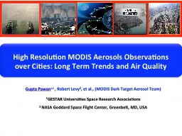
High Resolution
by karlyn-bohler
MODIS Aerosols Observations . over Cities: . Long...
Sea-Surface Temperature from MODIS
by luanne-stotts
Peter J Minnett, Robert H Evans and . Gui. Pode...
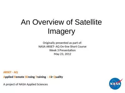
An Overview of Satellite Imagery
by beatrice
ARSET - AQ. A. pplied. . R. emote. . SE. nsing. ...
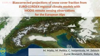
Biascorrected projections of snow cover fraction from
by morgan
EURO-CORDEX regional climate models with . MODIS r...
Terra 2.0 – The Vision
by daniella
Continuation and continuity of the Terra (AM polar...
Load More...